

Incantea Resort Tortoreto
Itineraries and excursions in Abruzzo close to the Incantea Resort
Our staff invites you to visit the more typical places and villages of the National Park, discovering its nature and magic and well preserved places. The National Park of the Abruzzo Region spreads in three regions: the Abruzzo, the Latium and the Marche, and it includes five provinces: L’Aquila, Teramo, Pescara, Rieti and Ascoli Piceno. 44 are the districts that are nestled into a wild nature; they have their culture, history, that make unique this area, one of the most extended and precious in Europe. Here the blooming and wild nature lives for centuries with a rich cultural heritage. Close to the Incantea Resort in Tortoreto, in Abruzzo, one can visit ancient villages, archeological places, castles, sanctuaries, abbeys, ancient churches, grottos all along the mountain landscapes, a nature that is really rich in woods, sources, falls, pastures, and rocky climbs. A special area even rich in typical artisan and typical works, food and wine, folklore… The falls, that are really numerous, deserve a great attention. One should visit them in May and June, when they are at their best, to appreciate them in all their beauty.
EXCURSIONS
Incantea Resort TortoretoThe total duration of the excurios includes: climb, stops, photos, use of the binoculars, packed lunch and… no sleep! Clearly the climb down is included too. As regard the winter excursions we have few words: it is something for experts! The itineraries can be divided into: T – Tourist itinerary: it is accessible to everyone even thanks to the not so long duration. E – Excursionist itinerary: it needs a minimum of experience and skills in orientation.
The villages
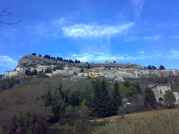
The stages of a unique and unrepeatable journey. The villages and villages of the park, with their architectural and cultural peculiarities, constitute the stages of a unique and unrepeatable journey. Among the many, set in the unspoiled and unspoiled nature, the villages of the ancient Baronia of Carapelle, close to the noble city of L'Aquila, deserve a visit: the Medici Santo Stefano di Sessanio, Castel del Monte, capital of Transhumance, Calascio with the famous fortress, Castelvecchio Calvisio, with an elliptical plan. Crossing the Piana di Navelli, famous for the cultivation of saffron, we meet Capestrano, in whose territory the Italic statue of the homonymous warrior was found, and Ofena, built with the white limestone of the Gran Sasso. In the district dedicated to the Benedictine Abbeys, there are the historic centers of Corvara and Pescosansonesco.
DetailsClinging to the rock, the ancient villages of Assergi and Camarda reveal important artistic values, in the green of the Monti della Laga as they alternate among others Cortino and Valle Castellana. Castelli, home of ceramic art and Isola del Gran Sasso, with the sanctuary dedicated to S.Gabriele dell'Addolorata, is worth a visit. Civitella del Tronto stands on the horizon with the mighty Bourbon fortress, with Campli, a farnese town in whose area the Italic necropolis of Campovalano persists. The thriving centers of Arquata del Tronto and Acquasanta with the typical sandstone houses, while the Strada Maestra reveals the charm of nature and culture of Campotosto, with its lake, Crognaleto, Fano Adriano, Montorio al Vomano, Pietracamela , under the Corno Piccolo, Pizzoli and Capitignano. On the Lazio side, Accumoli and Amatrice integrate the charm of the historic centers with the small rural villages surrounded by greenery, capable of surprising with masterpieces of art such as the Renaissance chapel of the Passatora Icon.
District Between the Two Kingdoms
Region: Abruzzo Province: Teramo
Municipalities: Campli, Civitella del Tronto, Torricella Sicura, Valle Castellana
The name
The denomination of the district alludes to the historical role of borderland between the Papal States and the Kingdom of Naples, which this harsh and wild area has played for centuries.
Nature and landscape
The profile of the territory is dominated by the specular shapes of the two mighty limestone mountains known as the "Twin Mountains", that is the Girella and Foltrone Mountains, locally called Montagna dei Fiori and di Campli, which rise up to 1800 meters, separated by the Salinello river which, from very distant eras, he dug into the soft limestone a narrow and wild ravine, with dizzying sheer walls, better known as "Gole del Salinello". The mountain of Campli is not casually called "Mountain of Flowers". Here the botanists of the park numbered 370 species: Gagee, Erysimum, Eliantemi, Globularie, Timi and Ginestrelle, a mosaic of colors and scents. Numerous rare species, such as Verbascum phoeniceum, the only species of mullein with purple flowers, and the living fossil Ephedra major. The presence of high and spectacular walls allowed the installation of truly unique bird species. Among the species present, in addition to the large birds of prey, such as the golden eagle, the mountain swallow, the gracchi, the red-tailed blackbird and the woodpecker are worth mentioning.
Structures present
The intervention of the Park Authority focused on the construction of a ring route that from Guazzano di Campli reaches Macchia da Sole, through the provincial road, suitably equipped with rest areas set up with picnic modules, fire points, sheds equipped with observation telescopes and explanatory lecterns which, depending on the color, inform about the nature, fauna, geomorphology and history of the territory, up to the ruins of Castel Manfrino and from there, through a well-equipped path along the Salinello Gorges, up to Ripe di Civitella. From this main ring there are several peripheral routes, but no less interesting, which lead to Valle Castellana, with its centuries-old chestnut woods, to Pietrastretta, from which you can enjoy a breathtaking view, to San Giacomo on Monte Girella, with the characteristics tholos agro-pastoral structures called "caciare", in Campli, with the Scala Santa, Palazzo Farnese and the important Italic necropolis of Campo Valano, finally, in Civitella del Tronto, with the most famous and best preserved Bourbon Fort in Italy.
Other cornerstones of the district are undoubtedly the Macchia da Sole Visitor Center which houses the Antiquarium of Castel Manfrino and the Grotta S. Angelo Museum. The cave, which has returned precious artifacts that attest to its attendance since the Upper Paleolithic, is set up with a series of illustrative panels that guide the visitor along the path. The cave museum is didactically connected with the Visitor Center of Ripe di Civitella, inside which the faithful reproduction of a prehistoric hut has been created. The tourist-cultural offer of the district is managed by the Park Authority through the Verdelaga Association.
From ripe to the Gole del Salinello
Departure: Borgo di Ripe (611 m)
Journey time: 2 hours
Difficulty: T / E
Difference in altitude: 130 m
Trail marker: marked white-red and yellow-red
Recommended period: from January to December
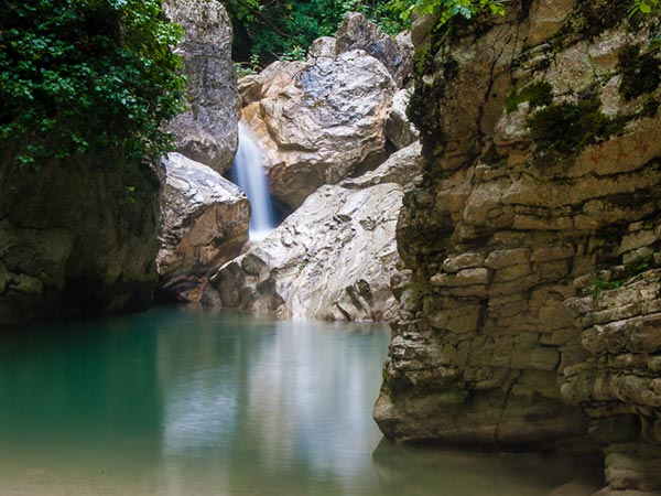
Adventurous ring itinerary in the suggestive Salinello Gorges, extraordinary environment carved by the waters, a small corner of paradise hidden between the Campli Mountain and the Mountain of Flowers. The "twin mountains", for those who look at them from a distance, have a rather sweet appearance, in contrast to what is observed entering the Salinello Gorges: steep walls secure the riverbed, rocks and pinnacles close up the thick belt of woods. In spring the gorges start singing again: it is the Salinello that performs in rapids, waterfalls and pools of transparent water that reflect the green of the walls around it.
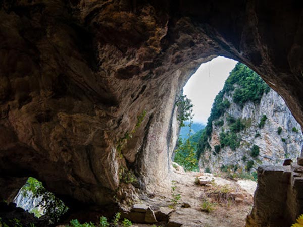
Many of the numerous caves that open on the walls of the valley were frequented since the Paleolithic era; in the medieval period, under the thrust of religious fervor, numerous places of worship arose ... S. Angelo di Ripe, S. Maria Scalena, San Francesco, S. Marco, S. Maria Maddalena. According to an oriental hermit tradition, some of these have a very impervious location; like eagle nests they are made in small cavities on the walls of the gorges, reachable only through steep paths.
The village of Ripe (611 meters) can be reached from the crossroads at km 17,300 of the main road 81, between the two crossroads for Civitella del Tronto used by those arriving from Teramo and the crossroads (in Villa Lempa) used by those arriving from Ascoli Piceno. Leave the car in the open space next to the church, climb for a few meters on the asphalt, and then turn left onto the road, closed to private traffic, which immediately becomes unpaved and continues slightly downhill towards the Salinello Gorges.
Once you reach an open space used as a parking area when the road was open to traffic, continue downhill for a more rough track. A path halfway up the slope, protected by a fence, leads to the base of the ramp that leads to the hermitage of Grotta Sant'Angelo (507 meters, 0.30 hours), which can be reached by a ramp. To visit the hermitage it is necessary to agree in advance with the Ripe Visitor Center. Returning to the main path, follow it with short ups and downs, overlooking the Gorges and reaching a new crossroads (Vroga delle Trocche, 587 meters). Here you leave the high path (itinerary Ö) for Castel Manfrino and descend, following the old yellow-red signs, for a steep ramp with steps and a fence. A path not marked on the left allows you to reach the base of the spectacular waterfall known locally as Lu Cacchèma (the big pot).
Returning to the main path, you reach the base of a boulder a few meters from the stream and continue on level ground towards the Gorges. After crossing a strip of wood, the path enters the most spectacular part of the ravine, overlooking the Salinello, which is interrupted here by some waterfalls, climbs with two turns and continues cutting a gravelly slope. Yellow-red signs on the right indicate the difficult itinerary for the hermitage of Santa Maria Scalena. A descent leads to a ford (490 meters, 0.30 hours), normally intransitable from autumn to spring. The return via the same route takes the same time (1 hour). Possible meeting with ... wolves, roe deer, golden eagle, wild boars, colubers, amphibians Necessary equipment: Backpack, mountain boots, fords, towel, trekking poles, helmet, layered clothing, rain cape, camera, binoculars, hat, sunscreen, packed lunch and water.
Through the Salinello Gorges
Departure: Borgo di Ripe (611 m)
Journey time: 2.15 hours
Difficulty: E (EE deviation for S.Francesco alle scalelle)
Difference in altitude: 500 m
From Ripe (611 meters) follow itinerary 10 towards Grotta Sant'Angelo, the Gole del Salinello, the junction with the high path (Vroga delle Trocche, 587 meters) and the first ford (490 meters, 0.30 hours).
DetailsYou cross it and continue on the orographic right, in the woods, with a very suggestive route, until you reach the second narrow passage of the ravine, which you cross along the vertical spurs and crossing the stream several times.
Where the gorge widens, cross the Salinello again and go up to the right, cutting a scree and crossing the valley of the Vroga della Caccia, until you meet the high path (777 meters, 1 hour) that cuts at the foot of the Mountain some flowers. Before the crossroads, on the right, an unmarked path that heads towards some rocky spiers and then descends obliquely to the hermitage of San Francesco alle Scalelle (675 meters, 0.30 hours a / r).
Continue along the old mule track from Ripe to Macchia da Sole. The track runs almost flat on the hillside, overlooks the Fosso del Lago, crosses it (847 meters) and reaches a saddle (945 meters) with tables picnic. To the left, on the ridge, you reach the ruins of Castel Manfrino (963 meters, 0.45 hours). Those who want to reach Macchia da Sole (910 meters) must go back to the last saddle and follow a mule track that descends halfway up the slope.
On the way back, follow the outward route to the crossroads 777 meters (0.45 hours), and continue halfway up the hill, crossing the Vroga della Caccia and a magnificent holm oak forest. Various lookout points offer splendid views of the Salinello. After passing a large landslide, you reach the Vroga delle Trocche, leave a path on the right for Grotta Sant'Angelo, reach a dirt road and follow it to Ripe (1.30 hours).
From Macchia da Sole to Castel Manfrino
Departure: Macchia da Sole (930 m)
Journey time: 1 hour
Difficulty: T - Tourist
Difference in altitude: 100 m
Trail marker: marked white-red
Recommended period: from April to November
The walk to Castel Manfrino starts from the Macchia da Sole car park, a small town that can be reached from the Garrufo crossroads on the main road 81, from Valle Castellana through the Valico della Cona, or from Ascoli Piceno to San Vito and the Valico della Croce di Korano (the last part of this road is unpaved, and sometimes in poor condition).
It is parked in the center of the town (930 meters) in front of the Park Information Center and the only bar-restaurant in the town. On foot, to the right for those arriving from highway 81, follow a road indicated by signs that reaches some dilapidated buildings. Continue along a clearly visible mule track halfway up the road, bypassing the ridge that dominates the town and reaching a crossroads.
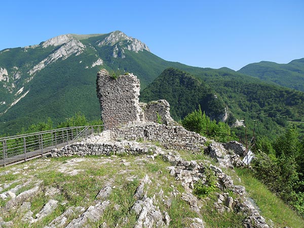
Here you go right, along a marked path and at times a little cluttered with vegetation that crosses the clayey valleys at the foot of the cliff that holds the castle, begins to climb alongside a limestone wall, passes a fork and reaches a ridge . A short climb in the dense forest leads in front of the imposing ruins of Castel Manfrino. A metal staircase allows you to reach the monument (963 meters).
We leave for the rocky ridge behind the gate until we reach a saddle (945 meters) with picnic tables. Leave a path on the right for the Canavine and one for the Salinello and Ripe Gorges, go down halfway, find the outward path and follow it up to Macchia da Sole. In all it takes 1 hour.
E - Hiking route
Requires a minimum of hiking experience and orientation skills. MOSCIO LACE FROM THE STONE
Difficulty: E (medium difficulty)
Difference in altitude +/- 1050 m
Total duration 1 day
"Pizzo di Moscio derives from mosa, mota: land soaked in water; among the numerous springs, the highest perennial source of the Laga is right here, at 2280 meters above sea level, on the east side ..." (See biblio 1 ). This before it was captured for use by the "snow gym" ...
The itinerary takes place on the Teramo side of the Monti della Laga.
Once in Ceppo (1334 m) continue to the crossroads near a campsite, where you can park. Leave the cart track on the right, which leads to the Morricana waterfalls, and continue on the Sentiero Italia (SI), which climbs up the ridge and with some unclear signs leads to the end of the forest.
Once out of the woods, go back to the Lago dell'Orso area (+/- 1805 m) where there is a small refuge. Following the large east ridge of Pizzo di Moscio, you pass the Iacci di Verre area, where the ruins of the former "snow gym" site are located, and continue on Storna until you reach the base of the Pizzo pyramid of Moscio.
Crossing left, clockwise, you go up the south-east shoulder to the summit. Remarkable panorama ...
THE MURRICANA WATERFALL FROM THE CEPPO
Difficulty: E (medium difficulty)
Difference in altitude +/- 400 m
Total duration 1 day
The Bosco Martese together with the Morricana waterfalls certainly represent one of the most suggestive corners of the Laga. The itinerary takes place on the Teramo side of the Monti della Laga.
Once in Ceppo (1334 m) continue to the crossroads, near a campsite, where you can park. You then follow the dirt road which on level ground, for a long time, crosses the Martese wood and after more or less 6 km reaches the end.
Continue on the path and, with another hour of walking, after having crossed countless ditches, you reach the first big jump of the falls. To observe the upper jumps you have to cross the stream on the right at best, guessed the path follow the slender track that diagonally climbs to the right approaching the edge of the Fosso Cannavine (another waterfall).
As the wood ends, you arrive at the Stazzi della Morricana, obliquely to the left after a short time you are in sight, on the edge of a deep ditch, of the second jump of the falls. The view on the north side of Pizzo di Moscio is beautiful. The Castellana Valley, below, is a sea of greenery.
THE MURRICANA WATERFALL FROM THE CEPPO
Difficulty: E (medium difficulty)
Difference in altitude +/- 600 m
Total duration 1/2 day
The Cavata waterfall is formed by the waters of the large east amphitheater of Pizzo di Moscio and is one of the many and beautiful waterfalls that the homonymous ditch offers us before reaching Padula. The itinerary takes place on the Teramo side of the Monti della Laga.
Once in Ceppo (1334 m) continue to the crossroads near a campsite, where you can park. Then continue on the Sentiero Italia (SI), which climbs up on the ridge and with some unclear signs leads to the end of the forest.
Once out of the woods (+/- 1700 m) you leave the SI, turn left (south), first meeting a stazzo and then the cart track, coming from Ceppo, which goes back to Iacci di Verre. Continue on the latter for a short stretch in the Colle Lungo area until the detour, to the left, which you follow slightly downhill through the Bosco di Langammella. Arrived at the bridge, on the Fosso della Cavata, climb left on traces of the path to "immerse yourself" in one of the most suggestive corners of the Laga.
Out of the woods you come across a large stazzo, you pass it and continuing to the right you reach the sandstone slide, following which you arrive in front of the waterfall. For the descent, it is certainly advisable to follow the SI which climbs the waterfall to the left and then crosses, remaining above the forest, until reaching the Lago dell'Orso area. After passing the small refuge, descend to resume the abandoned uphill track that quickly brings you back to the campsite.